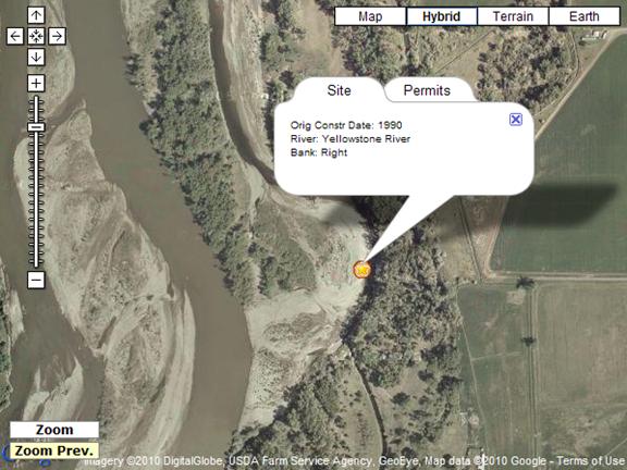
The 310 Permit Database project represents a great example of choosing the appropriate technology for the job. This usually saves time and money for our clients by avoiding more expensive, proprietary technology. For this project DTM Consulting chose the free Google Maps API over an approach such arc ArcIMS (now ArcGIS Server) to create an online mapping and database application for storing, maintaining, and displaying 310 Permit information managed by Conservation Districts. This is a statewide application with user-level security, a map interface, data entry and editing functions, search, display and reporting functions, as well as individual and public access.
The site is hosted by the State of Montana ITSD and utilizes SQL Server for database information and the GoogleMaps API for displaying map and spatial data. The web pages utilize a variety of programming languages including HTML, ASP, JavaScript and AJAX protocols.
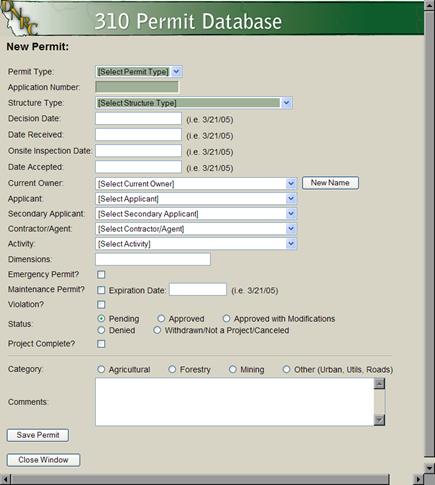
The application itself stores point data representing 310 Permit sites, as well as listings of individual permits within each site. The user has the ability to update a permit record as new information becomes available. Site photos can be uploaded to the database and displayed for each site or permit. Information for Guest users is limited to a sub-set of information to protect the applicant.