Starting in the early 2000s, the Yellowstone River Conservation District Council (YRCDC), in partnership with the US Army Corps of Engineers (COE) and a variety of State of Montana entities, began studying the cumulative effects of human impacts on the Yellowstone River. DTM has been involved with efforts by project partners to ensure that the diverse range of studies ultimately can work together to help understand the types and magnitudes of human impact on the river corridor.
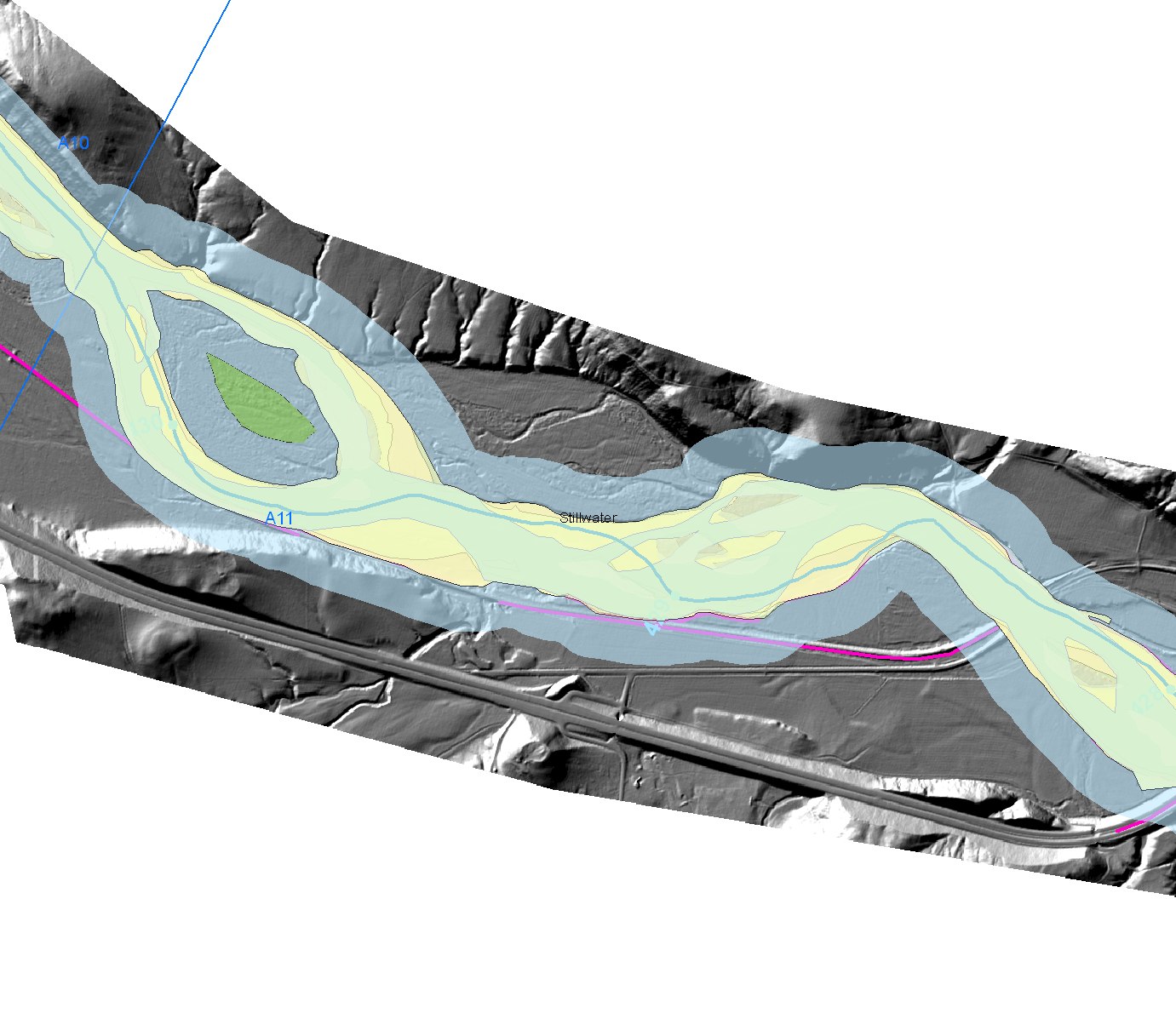
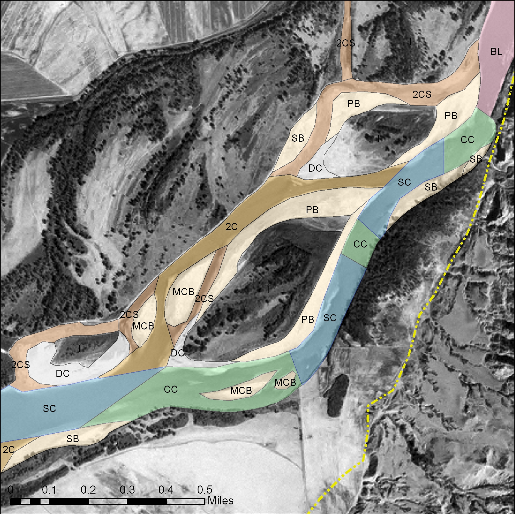
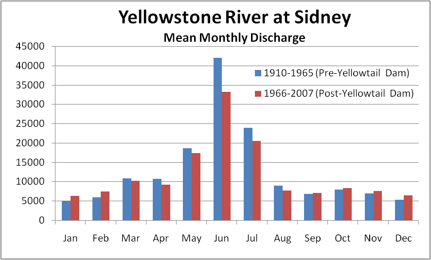
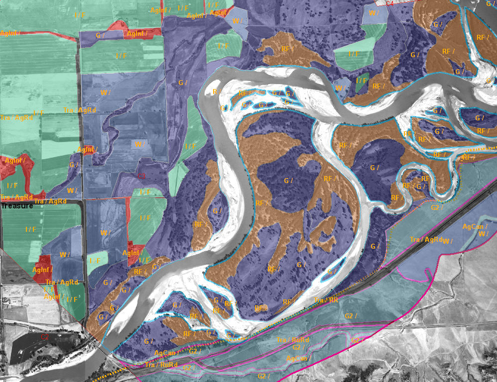
To date, the YRCDC and COE have sponsored a variety of data collection, compilation, and analysis studies to support the overall project goals. These include a geomorphic assessment, an avian study, a preliminary riparian vegetation assessment, detailed National Wetlands Inventory (NWI) wetlands mapping, an ongoing fisheries assessment, hydrology/hydraulics studies, and a socio/cultural inventory. DTM has been involved with the majority of these studies, including data development, analysis, and presentation of project information. These studies have generated an enviable data set spanning the length of the Yellowstone River. The Riparian/Wetland GIS Assessment is the latest in this series of data collection and analysis efforts and is targeted at understanding the existing and historic riparian and wetland conditions in the corridor, how these conditions have changed over time, and the influence of human activity on these changes.
DTM’s involvement includes the following studies:
- Geomorphic Reconnaissance, GIS development, and analysis
- Inundation zone modeling
- Riparian field study database
- Riparian vegetation delineation
- Human Impacts Timeline
- Fisheries habitat mapping
- Channel Migration Zone developement
- Cumulative Effects Atlas development
- Land use mapping and analysis
- Russian Olive and Saltcedar distribution analysis